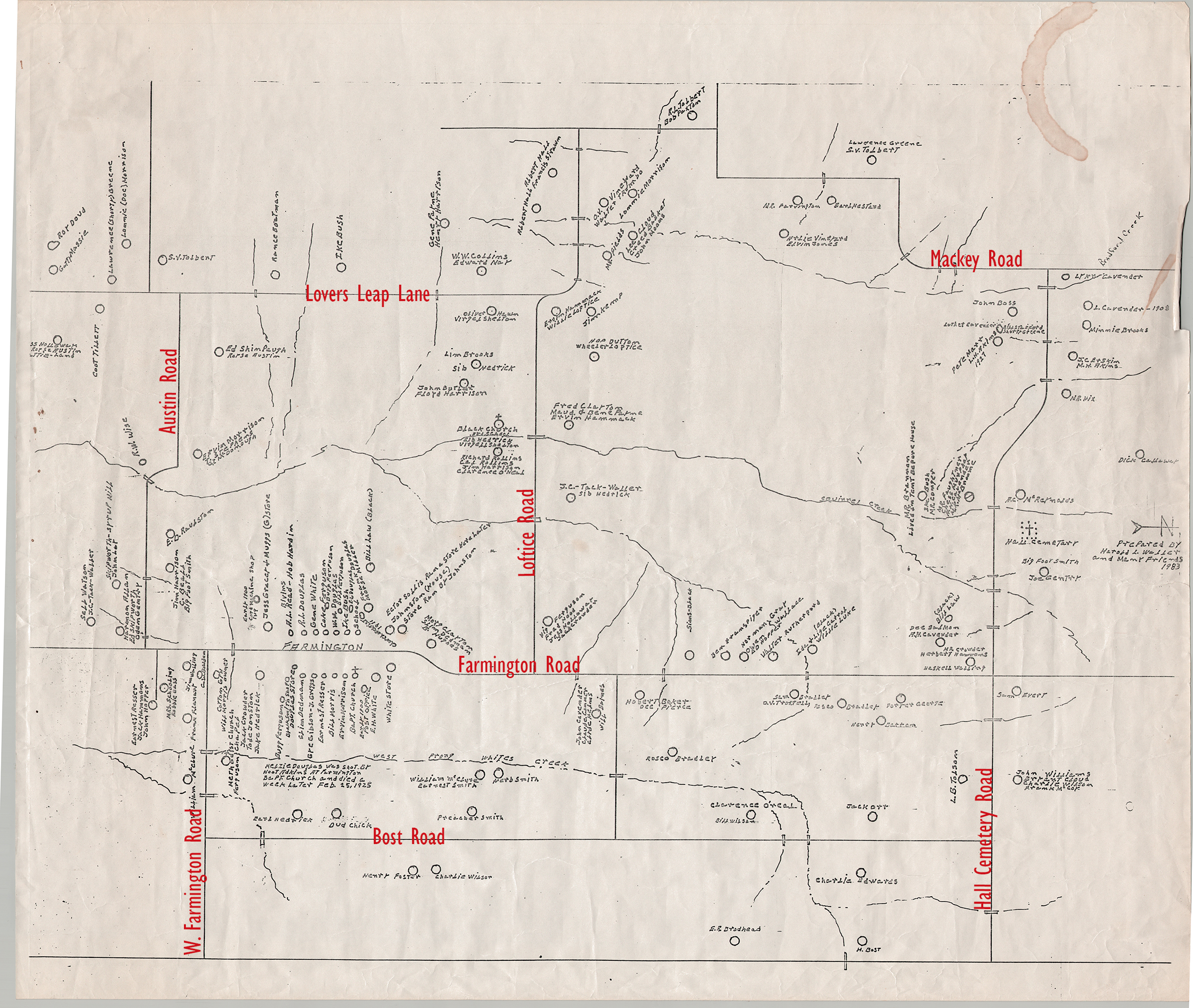

Longtime Howe civic leader, Linda Wall, recently discovered a map of the old Farmington community of the early 1900s. The drawings show to be made by Harold Waller in 1983 along with many friends. It was scanned by the Howe Enterprise thanks to TLD Design Consulting.
About 100 years later, the roads are in the same locations. The very bottom line of the map is the current location of US Highway 75. Just above that is Bost Rd. Hall Cemetery Road is seen on the right side of the map with Hall Cemetery marked.
One interesting note on the map is the following description, “Helzie Douglas was shot by Hoot Adkins at Farmington Baptist Church and died a week later, Feb 25, 1925.”