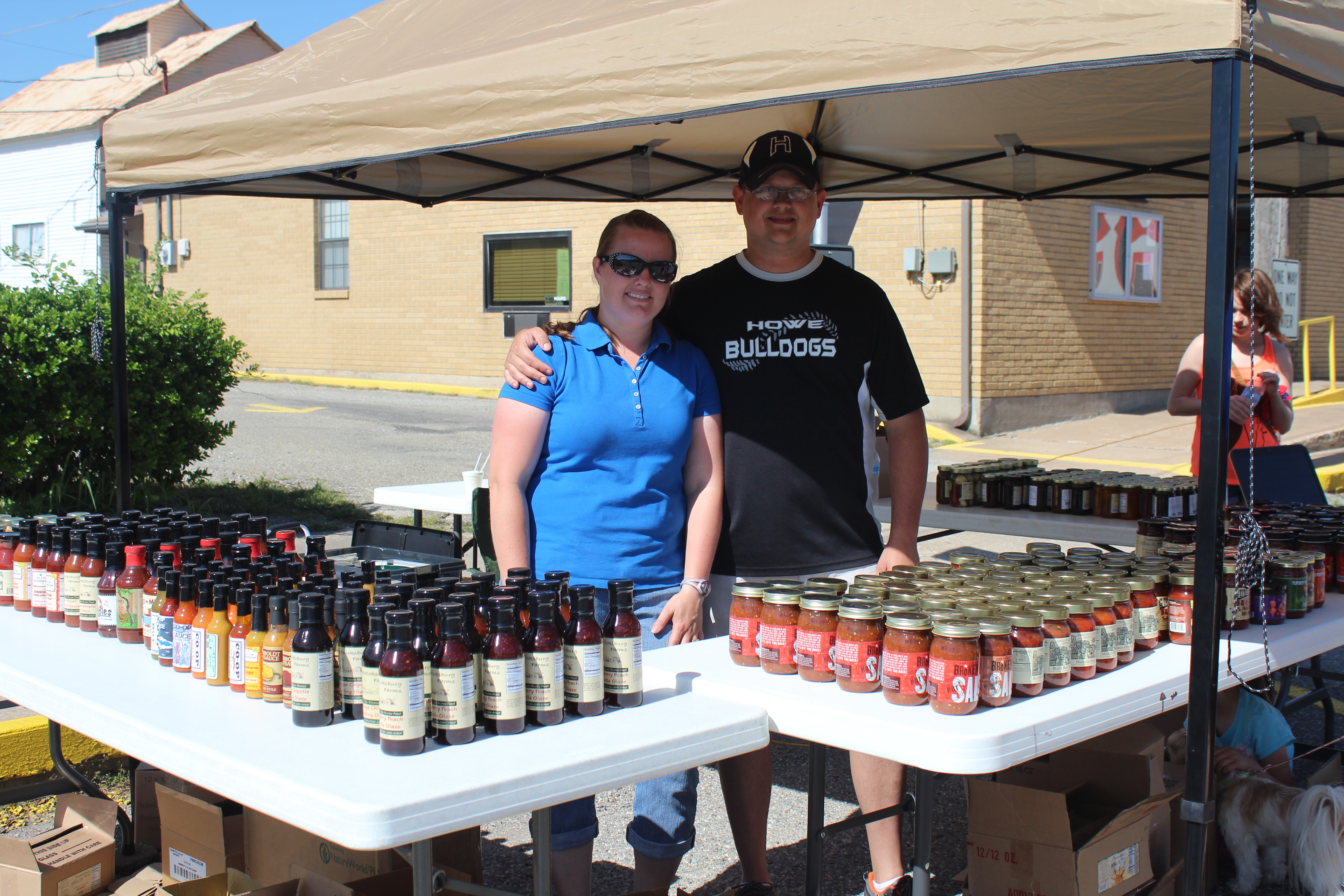
The Summit Salsa Company announced that they will soon be available in July in 144 stores in Kroger throughout Texas and Louisiana. The company, owned by Darrin Savage and wife Amber Tomberlin Savage. Full story in Monday’s Howe Enterprise.


Howe, Texas Hometown News Source Since 1963
The Summit Salsa Company announced that they will soon be available in July in 144 stores in Kroger throughout Texas and Louisiana. The company, owned by Darrin Savage and wife Amber Tomberlin Savage. Full story in Monday’s Howe Enterprise.
 On May 30 at approximately 11:50pm, Howe police officers Keith Milks and Jordan Clark arrested two women, both of Comanche, TX, late Saturday night after stopping them on US 75 at Haning Street for a traffic violation. Police reports state that a consent search led to the recovery of methamphetamine and drug paraphernalia from inside the women’s vehicle. The 38-year-old driver was arrested for Driving While License Invalid. Police say the 39-year-old passenger claimed ownership of the drugs and that she was charged with Possession of a Controlled Substance in Penalty Group 1, Less than one gram.
On May 31 at approximately 1:15am, Howe police officer Jordan Clark arrested a 20-year-old Heath, TX man for DWI after stopping him on SH 5 at N. Collins Frwy for a traffic violation. A police press release states that the suspect failed sobriety testing, and that he subsequently consented to providing a blood sample for alcohol testing. The suspect was taken to a local hospital for the blood draw and then booked into the Grayson County Jail.

Rare color footage of the 1957 spillway burst of Lake Texoma. The footage was uploaded to YouTube by Gil Nelson.

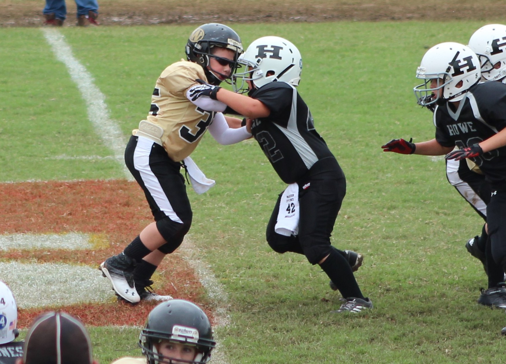 Howe Youth Football signups are online now. Click on the following link (http://www.leaguelineup.com/
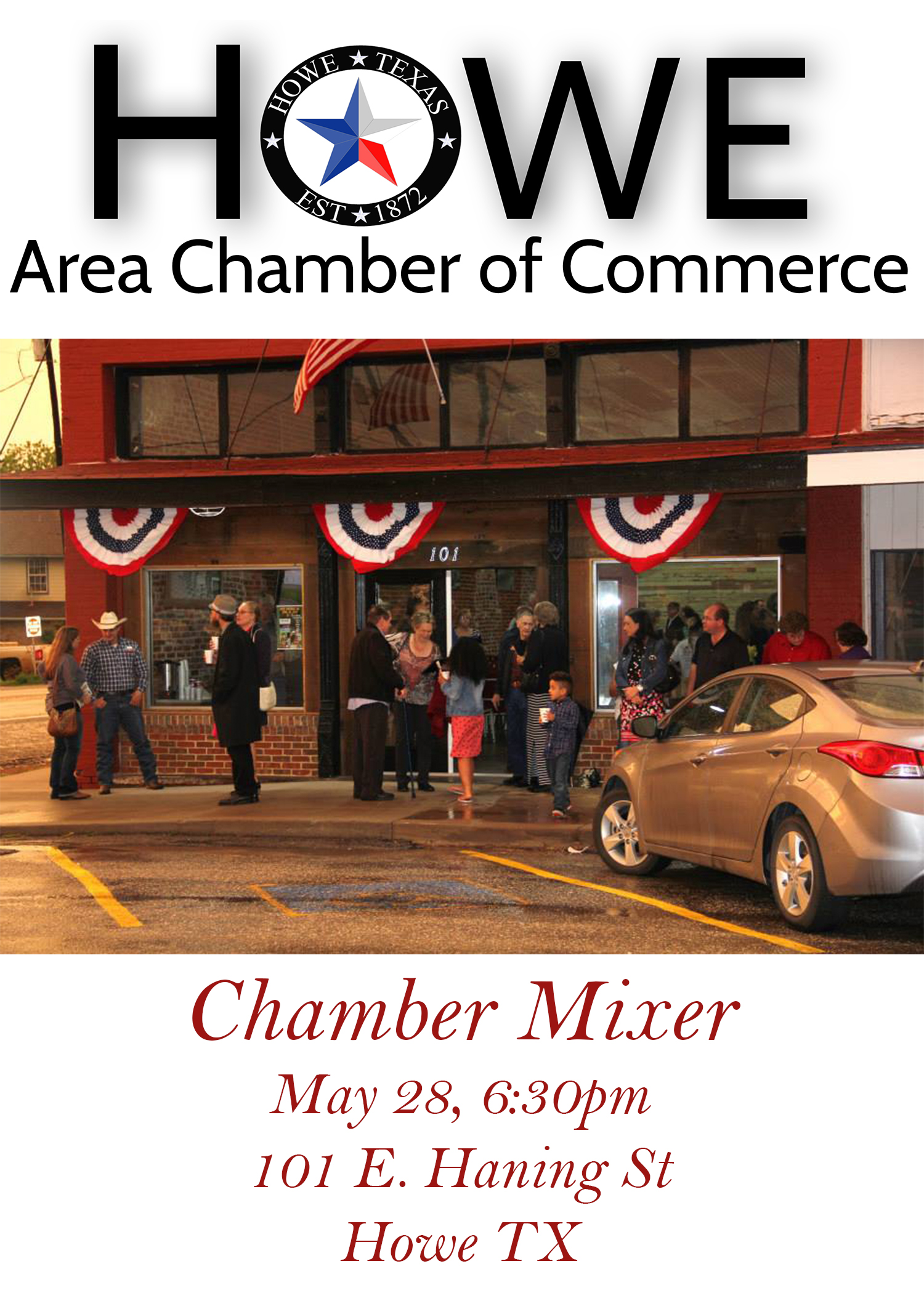
Tonight is the night for the first Howe Area Chamber of Commerce mixer in downtown Howe. Chamber President Robert Cannaday says that they are in the business of helping other business and tonight is the first of many big nights planned. The mixer will be held in the new Howe Development Alliance building, which is now complete and ready for the event tonight at 6:30 pm. The address of the new office is 101 E. Haning St., Howe, TX 75459. Abby’s Restaurant is providing some finger foods and the chamber will have coffee /punch and provide an opportunity to meet a lot of business leaders in the community. More information can be found on the chamber website at http://www.howechamber.com/.
“It’s an exciting new time in Howe and we’re anxious to see what prospers from evenings like this in our new revitalized downtown.” – Howe Development Alliance Director Monte Walker
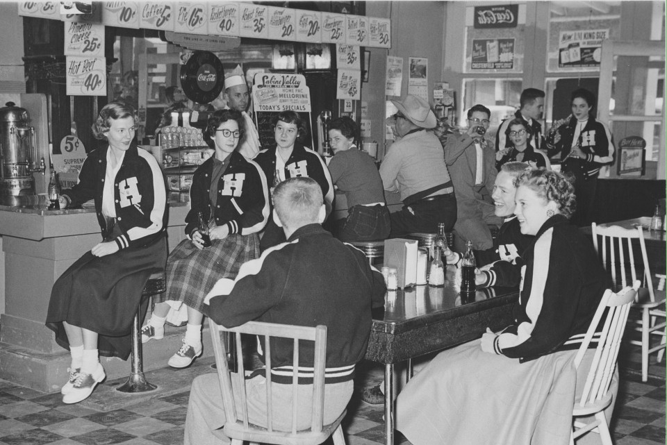
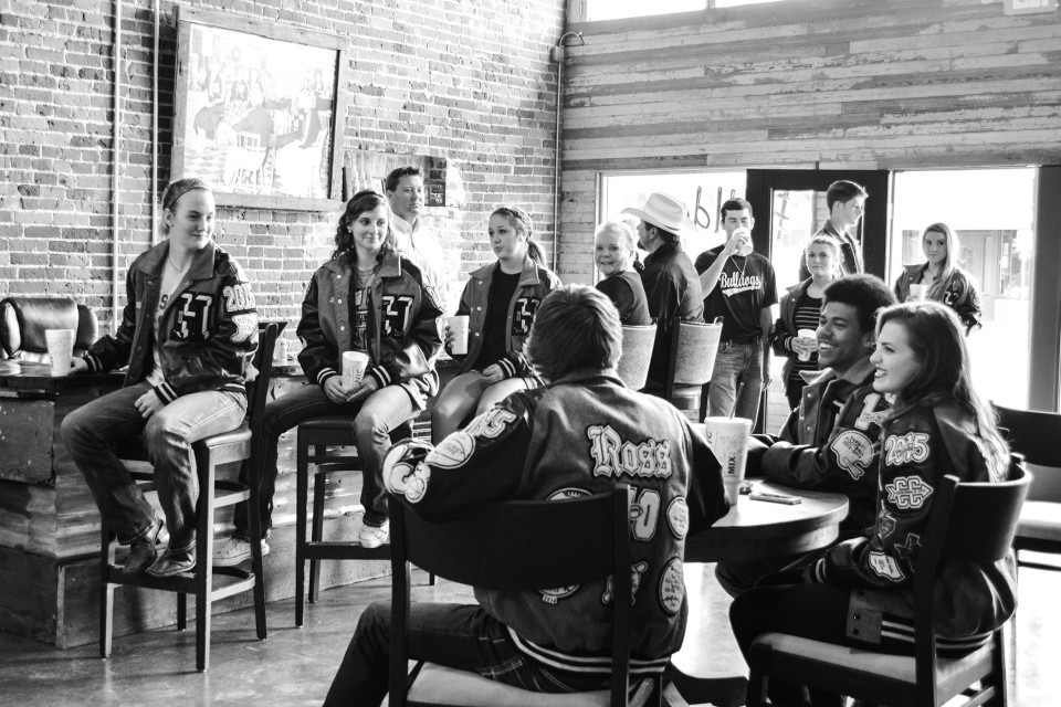
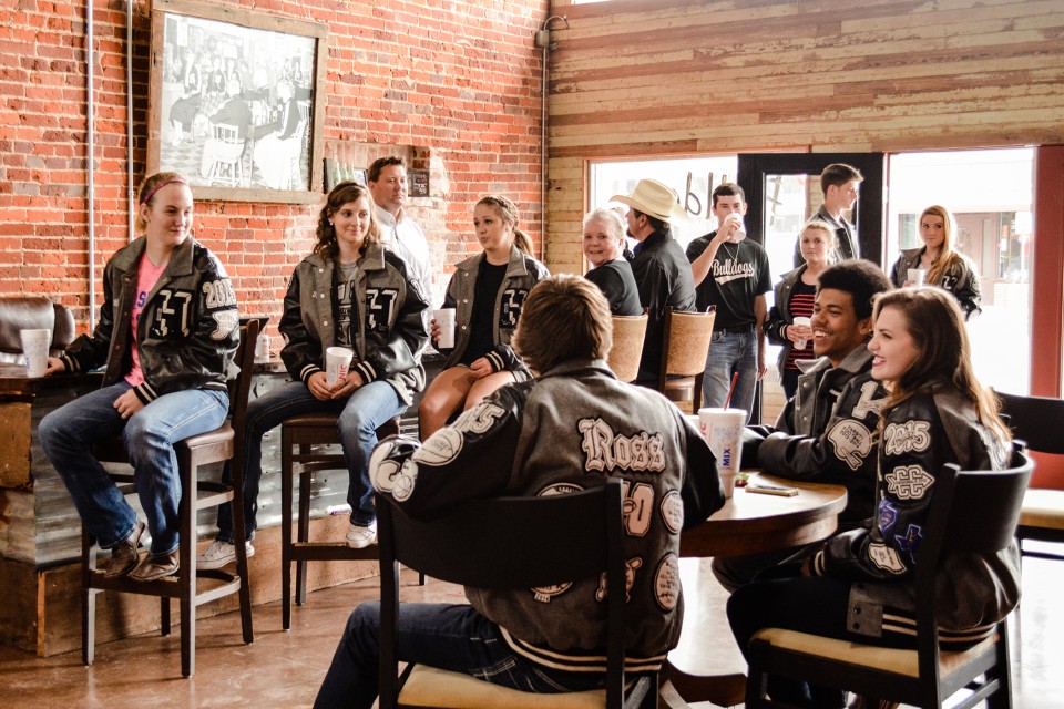
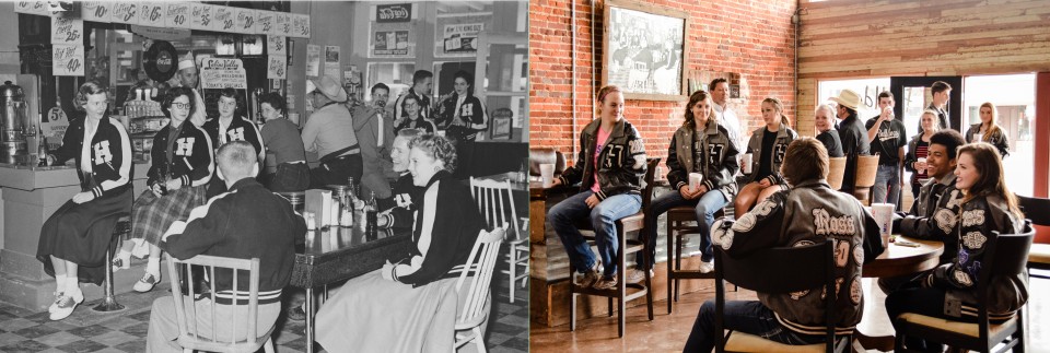
Some students from Howe High School recreated a photo from 1955 taken in the exact same building, in the exact same place 60 years ago. In 1955, 101 E. Haning St. in Howe, Texas was a classic 50’s diner named Ray’s Cafe. The building was recently refurbished and the 1955 photo was found. Beverly Jay Martin, the lady in the 2015 photo at the bar was the girl sitting down (far right) in the 1955 photo.
The new photo was taken by Victory Light Sports Photography in Howe.
In the photo:
At table-
1955 – Jack Norman; 2015 – Easton Ross
1955 – Elvis Arterbury; 2015 – Anthony Hawthorne
1955 – Beverly (Jay) Martin; 2015 – Kendall Nelms
At Bar-
1955 – Pat (Thompson) Anderson; 2015 – Bailey Tyler
1955 – Peggy (McReynolds) Estes; 2015 – Tiffany Lallier
1955 – Sue Thompson; 2015 – Meg Wilson
1955 – Unknown patron; 2015 – Beverly (Jay) Martin
1955 – Unknown patron; 2015 – Howe Police Chief Carl Hudman
1955 – Guy with bottle drink- Melton Vrla; 2015 – Quinton Harris
1955 – Jeanette (Davis) Sizemore; 2015 – Christina Counts
1955 – Jerry Buckner; 2015 – Levi Mrozinski
1955 – Sue (Chumbley) Schiffer; 2015 – Kaelen Powless
1955 – Behind the Bar- Onnie Ray Owner of Ray’s Cafe; 2015 – Monte Walker
Howe High School announced the valedictorian and salutatorian of the Class of 2015 on Wednesday morning during the awards ceremony. Tori Abner was announced as valedictorian and Leslie Rodriguez was announced as salutatorian. More in Monday’s Howe Enterprise.


May 23 – Howe PD Officer Robert Todd arrested a 29=year-old Van Alstyne man for DWI after stopping him for a traffic violation on South Collins Freeway. A search warrant was obtained for a sample of the suspect’s blood. Once at the hospital, the suspect refused to allow a nurse to draw the blood sample. Officers restrained the suspect and obtained the blood draw. The suspect was booked for DWI, Resisting Arrest, Search or Transport.
May 25 – Howe Police Officers Robert Todd and Keith Milks arrested a 34-year-old Pottsboro man in the 400 block of Haning Street for possessing less than a gram of Methamphetamine. The arrest was the result of a consent search of the man’s backpack.