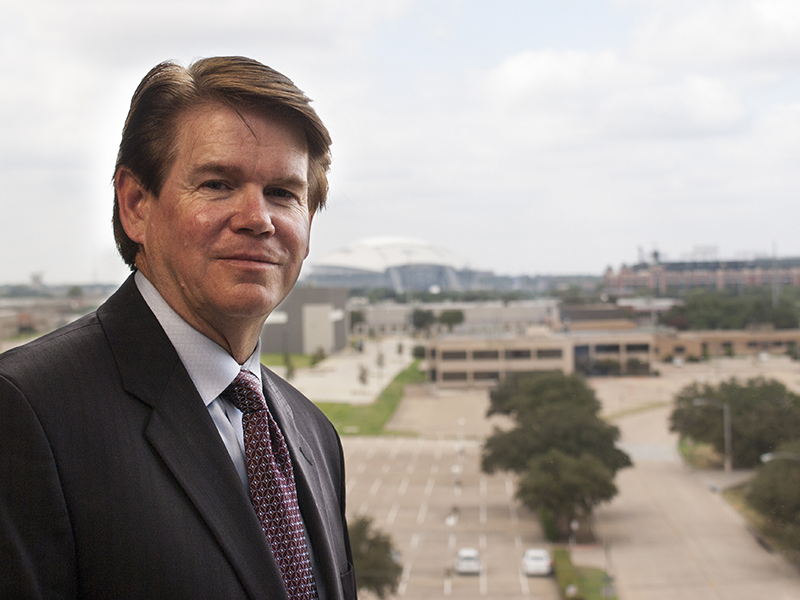
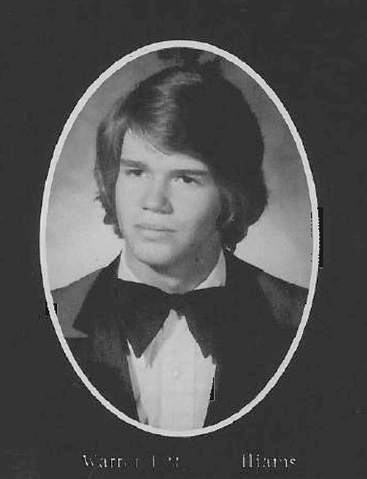
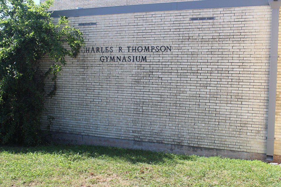
He’s the mayor of the city that has the most known professional football team in the universe. One of the star players on the Dallas Cowboys is veteran Jason Witten who wears the jersey number 82 and is one of the most known players in football history. But Arlington, Texas Mayor Jeff Williams once wore the number 82 and played his games, not at the new legendary Cowboys Stadium, but at one of the oldest football stadiums in all of Texas – Bulldog Stadium in Howe.
The Leon and Linda Williams family lived in the north edge of Sherman for a specific reasons so that their three boys and a daughter could attend Howe schools. Jeff Williams, the oldest of the four started school in Howe in the fifth grade in 1970.
Williams’ class of 1977 was the first to start the tradition of the ribbon-cutting ceremony which is still a part of outgoing senior activities at the end of each year.
“Our class was really close.” said Williams. “We did a lot of good projects and actually helped start the fall festival. We also raised money to put a marquee sign in front of the high school. My dad was on the school board at that time and that was a special memory. We set records for the amount of money that a class would raise.”
Four teachers at Howe High School stood out to Williams as being major influences at his time there. Janie Finney, Pat Stewart, Bettye Mullins and Norman Bennett.
 “Those are just some of the examples of the quality teachers that we had.” said Williams. “When I left Howe and went to Texas Tech, I didn’t know hardly anyone, but they had prepared me very well. That was a big step to go from 48 in our graduating class to go a university of 24,000.”
Williams said that being in a small school meant that almost everyone was involved with a lot of projects and activities, which made everyone feel needed.
“I think that translated into our lives realizing that we needed to contribute to the community and the schools for our kids.” said Williams. “It taught us a lot of responsibility.”
Williams went to state in UIL speech and served as class president for several years. Those leadership skills that would later make him mayor of a major city were being honed and developed in Howe. While at Howe High, he took a test that would tell a student what they might be suited for in a career field. Williams tested high for becoming an attorney. His score was so high in math, that the school counselor, Norman Dickey, told him to consider getting an engineering degree before law school.
Williams, with his family deeply trenched in the construction business went on to get his civil engineering degree from Texas Tech and while there was elected vice president of student body.
“The reason I ran for that instead of president was because the vice president was the student lobbyist said Williams. “So I spent my senior year in Austin and Washington D.C. a whole lot.”
Seeing so much corruption in both of those high-powered capitol cities soured him in politics. But he wasn’t soured by a girl he met that year that eventually became his wife.
Soon after college, he was recruited by several engineering firms and while wanting to get married, took a job and fell in love with engineering and the building communities.
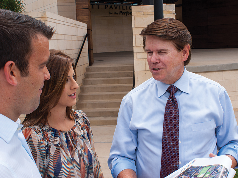
Williams had his civil engineering fingerprints on projects such as The Ballpark in Arlington (now Globe Life Park) and Cowboys Stadium (now AT&T Stadium), Southlake Town Square, Park Central at US75 and 635, Parks Mall in Arlington. He’s also done parks projects such as River Legacy Park in Arlington and numerous others.
“I just really enjoyed it and enjoyed working with the communities and design things.” said Williams who decided not to go to law school and instead focus on his engineering career.
That career began with the Arlington based company called Graham Associates in 1984, which he later purchased in 1988. Williams has expanded locations to Frisco and Fort Worth as well as Arlington where he still gives strategic direction even while serving his term as mayor of Arlington.
It is most common for a mayor to be elsewhere employed while holding office. Former mayor of Arlington, Richard Greene, was the manager of Vandergriff Acura while serving as mayor from 1987-1997. It was Greene who reached out to Williams to recruit him along with dozen community leaders to provoke him to run for mayor of Arlington.
Williams took a few weeks to chew on the idea of whether or not it would affect his engineering firm. With the life expectancy now going up, it was a major consideration and factor of whether or not this would affect his life beyond the mayor’s office.
“I’m not interested in making a career out of being mayor.” said Williams. “I want to come in and help my community and get us moved to another level.”
Williams says that Arlington is not in bad shape, but is not to the high level that they need to be and want to be in his opinion.
“We have incredible attractions and venues here in Arlington with Six Flags, Globe Life Park and then the greatest special events center anywhere in AT&T Stadium.” said Williams. “But yet we have not attracted other entertainment venues or other businesses so to speak of to add to that and that’s been very frustrating to the leadership in Arlington. I think they thought that when AT&T Stadium was built, that they would come. And you just can’t sit back and wait on that. Other cities are too aggressive.”
Williams as an engineer with a leading engineer firm, has been asked to recruit businesses from other large cities. One of those that he just finished was Nebraska Furniture Mart in The Colony. He says it will be the largest retail store in America. Williams did all of the civil engineer work on property.
“We were also there to help sell them on the land that The Colony was wanting to locate.” said Williams.
The 1.9 million square feet project was a Warren Buffett Berkshire Hathaway project which in comparison is larger than the 1.2 million square feet Stonebriar Mall. By the way, IKEA is a trifling 200,000 square feet.
“They will draw around ten million visitors a year and will become the top tourist attraction here in the metroplex.” said Williams.
After a 400 acres purchase, Williams’ company put in all of the infrastructure so that it is ready for a future town center and a small community in itself. Nebraska Furniture Mart took up 100 acres leaving the 300 acres ready to make The Colony set to become one of the largest tax-toting cities in the country.
The Colony, with a premier piece of land, recruited Buffett to invest in their city so that they would have better police, fire and all that comes with a larger tax base.
All of those dealings and relationships, Williams found himself in attracting city leaders to recruit him and his expertise to be the front man for Arlington. After a successful campaign, he was elected mayor on May 9 and defeated incumbent Robert Cluck 10,161 votes to 7,119.
“We will be becoming very aggressive in going after businesses and bringing in jobs here to Arlington.” said Williams. “Also, we want to create more attractions in the entertainment district to once again become ‘The Entertainment Capital of Texas.’ We have the best geographic location being in the center of the metroplex and right at the entrance to DFW International Airport. All of that factors in.”
Williams also says that he wants to partner with all of the educational institutions from The University of Texas at Arlington to Tarrant County College to the school districts and private schools.
“Great cities have education as their foundation and we have let that slide and I would like that to be back on the front burner.” said Williams.
Williams also wants to partner with other surrounding cities due to the fact that North Texas is one of the top places for people to live work and play.
“The projections are that we will have three million people moving into the metroplex over the next 12 to 15 years, so that provides great opportunity.” said Williams.
As impressive as the mayor, the first lady of Arlington is also a community leader. Karen Williams is a PTA Lifetime Achievement Award winner and headed up many organizations in the school district. She’s been the president of the Arlington Martin High School Choir Booster Club as well as heading up the Education Foundation events. The family attends First Baptist Arlington and she’s been a 20-year Bible Study Fellowship leader. For the past 15 years, she has headed up the women’s ministry.
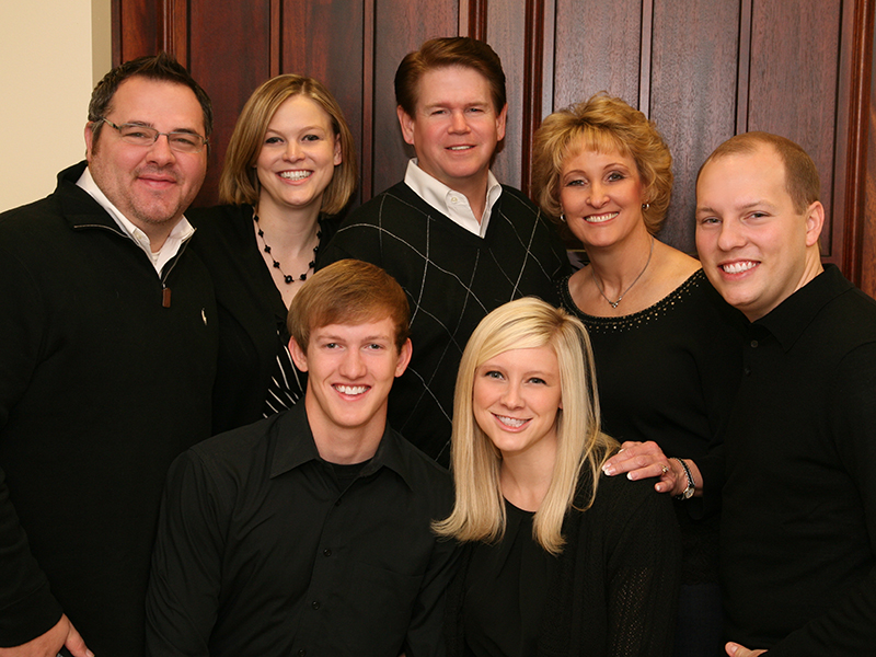 As now ’empty nesters’, Jeff and Karen Williams have three children, Natalie Pollitte, Suzanne Taylor and Ryan Williams. Oldest daughter Karen is a teacher at Wylie ISD, while Suzanne is the Director of External Affairs at Texas Tech. She was the president of the student body and was recruited to come back to Tech for the position she holds. The youngest Ryan, is a senior at Tech and will graduate this August. He was president of president select which was over the academic and athletic recruiting.
As the Howe High School Class of 2015 walked off the stage on Saturday, one can only wonder which student just might be headed for tremendous success after leaving this village on top of the hill. There have been some very impressive students graduate from this small school in North Texas, however, none have gone from Bulldog Stadium to AT&T Stadium or Haning Street to Nolan Ryan Expressway.


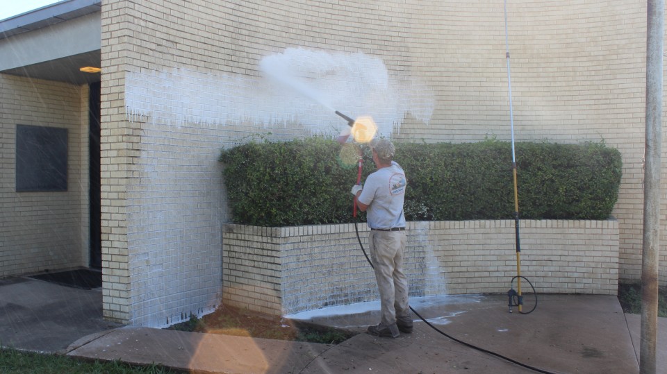
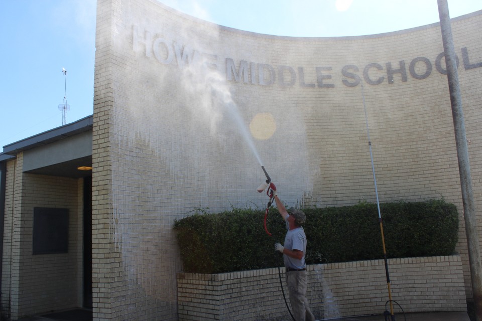

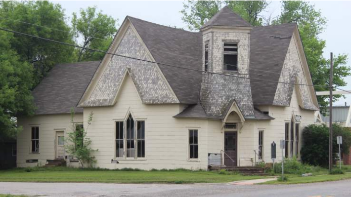 day night at First United Methodist Church, a Great Days of Service meeting took place and most of the meeting was dedicated to the discussion of whether or not to spend volunteer hours and funds on the beginnings of a complete rehabilitation of the old First Christian Church on the southeast corner of Denny and O’Connell Streets. The Great Days of Service committee chairs Clyde Hepner and Bruce Evans had previously met with Keep Howe Beautiful President Monte Walker to lay out a plan to complete the restoration in several phases. Due to support from the Great Days of Service committee, the first phase will be completed this month by their volunteer organization.
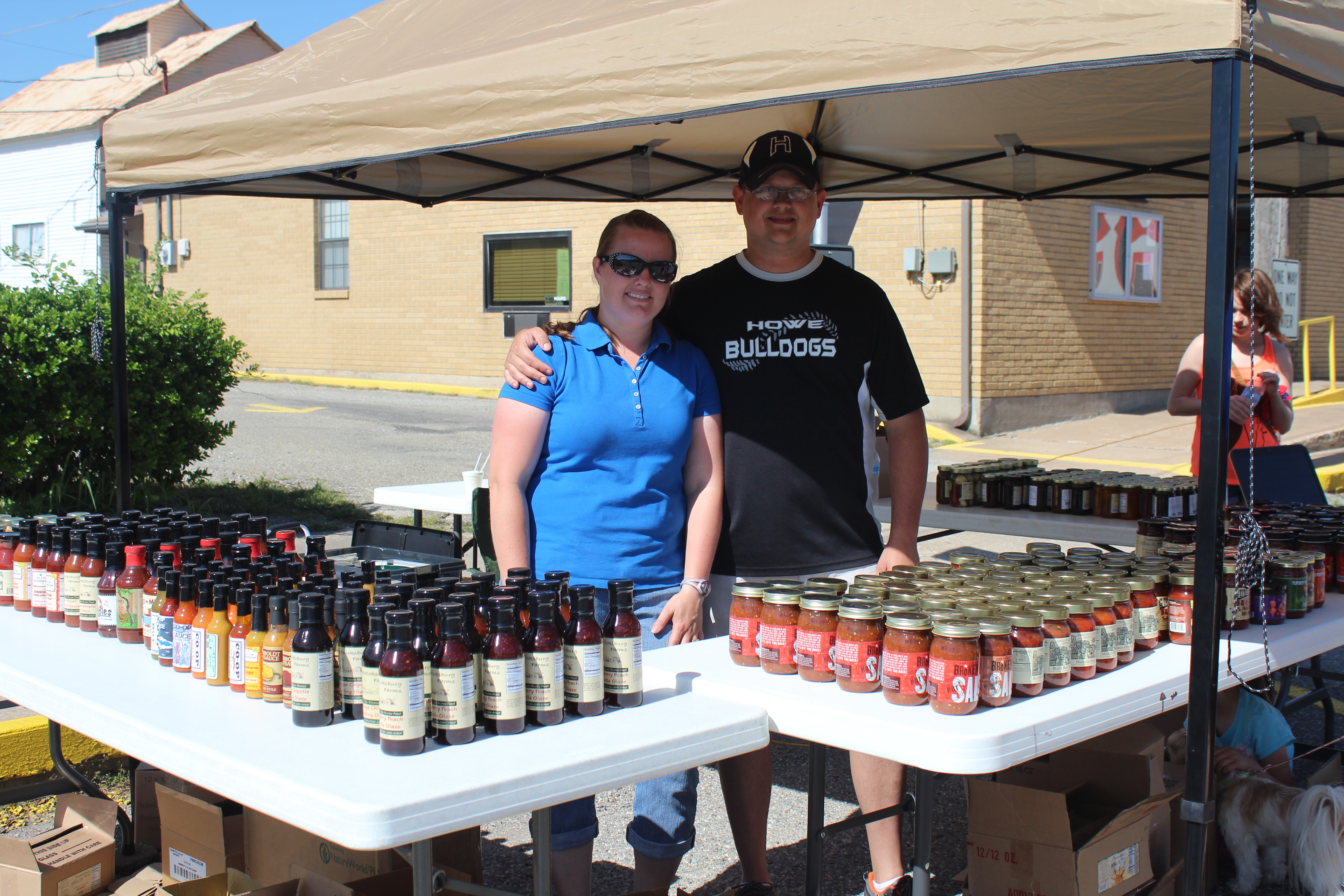
 began with a simple internet search and County Fair Foods were one of the few copackers that had a website, so Savage became familiar with the program. Savage had to visit the Arlington company and do several ‘recipe runs’ to make sure his recipe was precisely duplicated by County Fair Foods. After a month of tweaking, they sent the salsa off to a lab to verify its acidity to make sure it was shelf-stable and see how long it is shelf-stable. Once that was all approved, it was time to start ordering.
 ue industry, Summit Salsa Company’s customer is the distributor (which is Jake’s Finer Foods of Houston) and not the grocery store although they want to interact with them as they are.
 up to weed out guys like Savage – the ‘mom and pops.’ Most people in his situation don’t go for copackers that do bigger batches so they’re not able to get their cost down. Those end up hand delivered to specialty stores. But Savage’s dream is to be a large manufacturer one day with Summit Salsa all over the country.